Program Overview
Program inquiry question:
What can be done to improve liveability in flood prone urban areas?
This excursion combines the Year 7 units of 'Water in the world' and 'Place and liveability' in Version 9 of the Australian Curriculum. With a focus on the flood prone suburb of Rosalie, students explore the catchment of Western Creek and come to understand the potential impacts of flood risk on the liveability of the area.
To assist with student understanding of the ways in which water connects and changes places as it moves through environments, the principles of Water Sensitive Urban Design (WSUD) are used to assess how well the suburb is managing water at individual property and street level. The criteria for the 20-minute neighbourhood are also used to assess the current liveability of the area so that students can better understand the impacts of flood on the liveability of the area in a time of climate change. In this way, students are well placed to make informed data driven recommendations as to how the suburb's liveability can best be protected through the management of water.
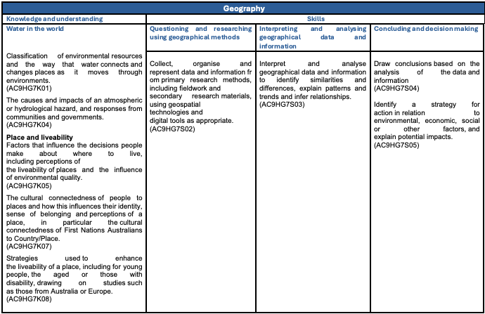
Curriculum links

Make a booking!